Fine example of the rare first edition of De Brahm's 4-sheet map of South Carolina and Georgia, published by Thomas Jefferys in London in 1757. Very good condition; 43.5 inches x 48.5 inches
De Brahm's map is the most important and influential map of South Carolina and Georgia during the British Colonial era. As noted by Cumming, "For the first time, for any large area of the southern colonies, a map possesses topographical accuracy based on scientific surveys.”
De Brahm was a German born military officer who befriended the Bishop of Augsburg, who was then promoting a Georgia Colony to displaced Germans. De Brahm emigrated to Georgia in 1751 and was soon employed as a surveyor in Georgia and South Carolina, where he was appointed surveyor general in 1754. De Brahm undertook an extensive coastal survey during the first part of the decade. As noted by Henry Taliaferro:
In 1752, De Braham announced plans to publish a new map of both colonies in an advertisement in the South Carolina Gazette, in which he invited plantation owners “who desire to have their particular Plantations inserted therein … to send copies of their respective Plats.” The completed manuscript was sent to London where the Board of Trade approved it and commissioned Thomas Jefferys to publish the work. At the lower center is a dedication to Lord Halifax, the President of the Board of Trade.
The map is drawn on the grand scale of one inch equals five miles. It shows the coastal areas from the North Carolina boundary southward to St. Marys River in Georgia, then inland to the Indian Country. For the coastal region and up the major rivers as far as the settlements extend, great care and detail in surveying is evident. The amount of topographical information given in the low country is impressive; swamps, marches, and the winding of tidal channels and rivers are delineated. The boundaries of all the organized parishes in South Carolina are laid down. At lower center is a lengthy index to land holdings in South Carolina, the obvious result of his address to planters in 1752.
De Brahm included an unusual feature along the border between North and South Carolina. Entitled “The Nature of the Land in this Course,” it is an analysis of the topography De Braham observed when he ran the forty mile boundary line inland from the mouth of inland creek. It almost has the character of aerial photography. This feature was omitted from the second state of 1780.
The map is a vast improvement over earlier maps, accurately depicting the course of rivers and tributaries, correctly locating islands and parishes. An unsual topographical section is included at the northern border. The cartouche illustrates the colonies lucrative indigo trade.
De Brahm's map is known in two editions, this 1757 edition and a heavily revised second edition, issued in 1780 with a different title.
 (Italian, 1826-1899) View of the Alhambra, 1892, signed lower left "A. Pasini" and inscribed indistinctly lower right, oil on canvas, 21-1/8 x 14 in., original gilt wood and composition frame, lined and restretched on original stretcher, retouch at top middle edge at repair, conservation report attached verso, Colin Post, Asheville, N.C.; frame with abrasions.
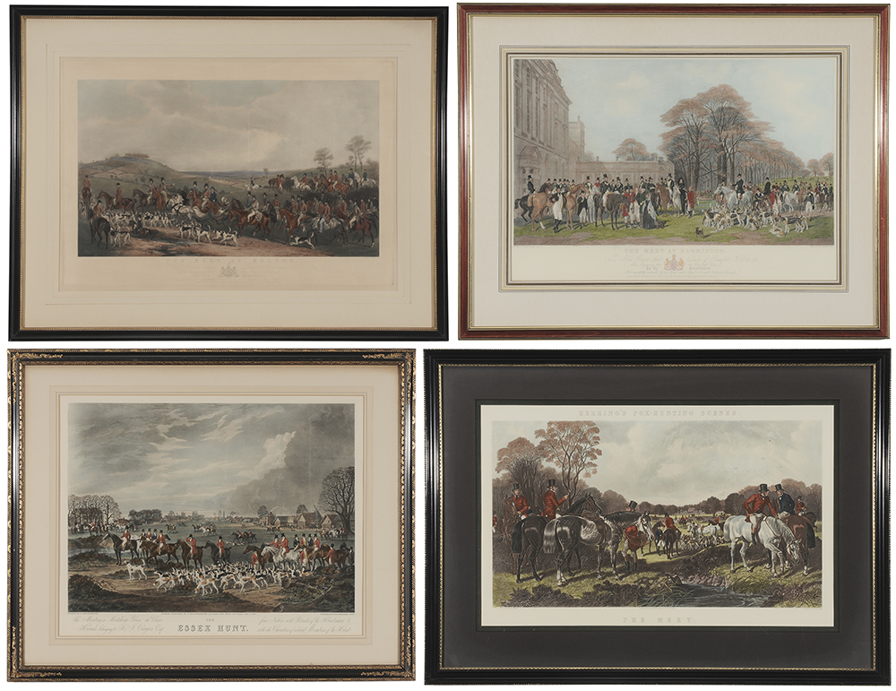 (British, 19th and 20th century) "The Meet", after Herring, restrike by Victorius, Virginia, 21 x 33-1/4 in. (sight); "The Meet at Badminton", after W. & H. Barraud, 20 x 29-1/4 in. (sight); "The Meet at Melton", after F. Grant, 22 x 34 in. (sight), toning; "The Essex Hunt", after D. Wolstenholme, 21-3/4 x 27-1/2 in. (sight), Ackerman label verso, hand colored engravings; painted wood frames, not removed from frames.
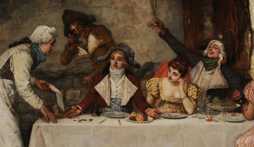
 (British, 1834-1919) The Young Prodigal and His Friends, signed lower right "G.A.S." with artist's label and remant of exhibition label verso with title, oil on canvas, 40 x 63 in.; gilt wood and composition frame, lined, restretched on original stretcher, scattered retouch throughout, flattening and consolidated crackle; frame with abrasions.
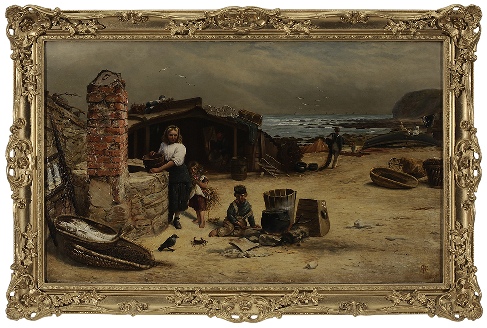 (British, 1841-1897) "Touch Me If You Dare,"1877, signed lower right conjoined monogram "JMc/1877", oil on canvas, 21-7/8 x 36-1/8 in.; gilt wood and composition frame, lined with translated inscriptions verso on lining, restretched on original stretcher,retouch in sky and right bottom edge, crackle; frame resurfaced.
 (German, 1864-1941) The Serenade, 1890, a flirtatious gent with two elegant young ladies beneath a portrait of their father peering down in possible disapproval, signed lower right "L. Schmutzler '90", oil on canvas, 16 x 23-3/4 in.; modern gilt wood and composition frame, lined with wax and linen, crackle, no apparent retouch, conservation by Ray Ketcham, Atlanta, Georgia, 1976; frame with abrasions.
 Fine example of the rare first edition of De Brahm's 4-sheet map of South Carolina and Georgia, published by Thomas Jefferys in London in 1757. Very good condition; 43.5 inches x 48.5 inches De Brahm's map is the most important and influential map of South Carolina and Georgia during the British Colonial era. As noted by Cumming, "For the first time, for any large area of the southern colonies, a map possesses topographical accuracy based on scientific surveys.” De Brahm was a German born military officer who befriended the Bishop of Augsburg, who was then promoting a Georgia Colony to displaced Germans. De Brahm emigrated to Georgia in 1751 and was soon employed as a surveyor in Georgia and South Carolina, where he was appointed surveyor general in 1754. De Brahm undertook an extensive coastal survey during the first part of the decade. As noted by Henry Taliaferro: In 1752, De Braham announced plans to publish a new map of both colonies in an advertisement in the South Carolina Gazette, in which he invited plantation owners “who desire to have their particular Plantations inserted therein … to send copies of their respective Plats.” The completed manuscript was sent to London where the Board of Trade approved it and commissioned Thomas Jefferys to publish the work. At the lower center is a dedication to Lord Halifax, the President of the Board of Trade. The map is drawn on the grand scale of one inch equals five miles. It shows the coastal areas from the North Carolina boundary southward to St. Marys River in Georgia, then inland to the Indian Country. For the coastal region and up the major rivers as far as the settlements extend, great care and detail in surveying is evident. The amount of topographical information given in the low country is impressive; swamps, marches, and the winding of tidal channels and rivers are delineated. The boundaries of all the organized parishes in South Carolina are laid down. At lower center is a lengthy index to land holdings in South Carolina, the obvious result of his address to planters in 1752. De Brahm included an unusual feature along the border between North and South Carolina. Entitled “The Nature of the Land in this Course,” it is an analysis of the topography De Braham observed when he ran the forty mile boundary line inland from the mouth of inland creek. It almost has the character of aerial photography. This feature was omitted from the second state of 1780. The map is a vast improvement over earlier maps, accurately depicting the course of rivers and tributaries, correctly locating islands and parishes. An unsual topographical section is included at the northern border. The cartouche illustrates the colonies lucrative indigo trade. De Brahm's map is known in two editions, this 1757 edition and a heavily revised second edition, issued in 1780 with a different title.